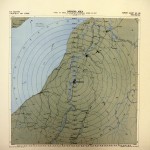
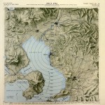
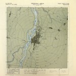
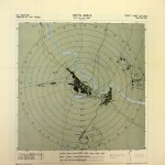
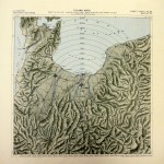
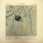
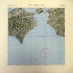
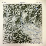
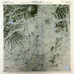
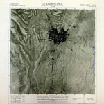
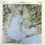
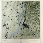
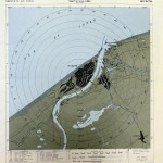
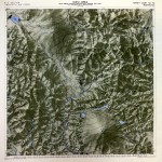
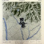
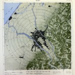
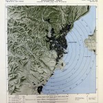
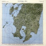
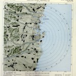
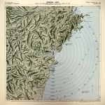
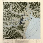
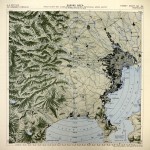
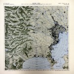
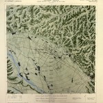
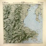
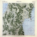
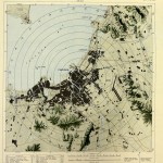
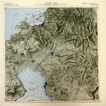
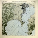
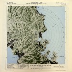
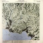
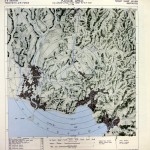
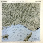
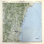
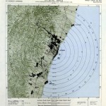
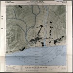
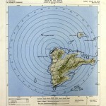
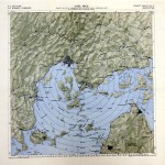
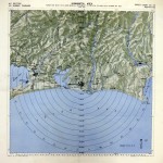
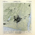
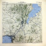
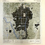
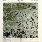
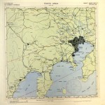
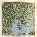
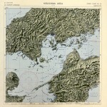
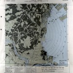
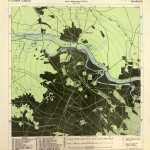
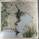
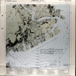
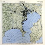
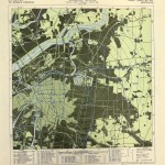
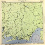
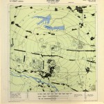
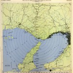
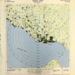
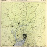
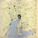
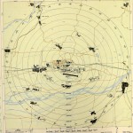
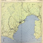
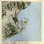
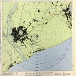
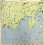
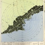
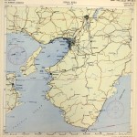
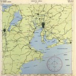
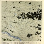
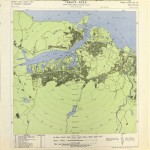
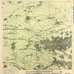
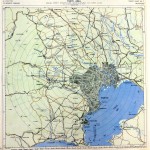
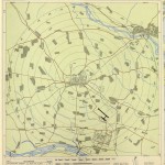
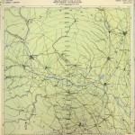
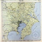
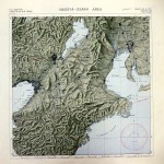
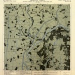
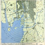
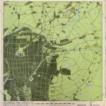
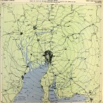
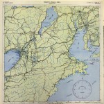
The following “Target Charts” are important visual documents that played a central role in the air raids carried out against Japan. An examination of these highly professional maps reveals a number of important themes, the most important of which is that the Army Air Forces eventually adopted a policy and practice of targeting entire cities for destruction via incendiary bombing. The maps were produced between January and August, 1945, under the direction of the Twentieth Air Force/XXI Bomber Command’s A-2 Section, the intelligence and analysis branch of the command. Compiled largely from aerial photographs taken by the 3rd Photographic Reconnaissance Squadron, the Guam-based 35th Photo Technical Unit and 949th Engineering Aviation Topographical Company created and reproduced the maps. Source: U.S. National Archives, Cartographic and Architectural Section, Record Group 18, 330/6/9/3-8.
-
- Nagaoka
-
- Omuta
-

- Nagaoka
-
- Nagaoka
-
- Mito
-
- Toyama
-
- Toyama
-
- East Shikoku
-
- Maebashi
-
- Utsunomiya
-
- Utsunomiya
-

- Ube
-
- Handa
-
- Okazaki
-
- Niigata
-
- Kofu
-
- Kofu
-
- Kanazawa
-
- Kagoshima
-
- Kagoshima
-
- Yokkaichi
-
- Nobeoka
-
- Nobeoka
-
- Sagami
-
- Sagami
-
- Sagami
-
- Tsu
-
- Sendai
-
- Fukuoka
-
- Kurume
-
- Katase
-
- Yokosuka
-
- Katase
-
- Katase
-
- Himeji
-
- Hitachi
-
- Hitachi
-
- Hiratsuka
-
- Moen Island
-
- Kure
-
- Hamamatsu
-
- Hamamatsu
-
- Kyoto
-
- Kyoto
-
- Osaka
-
- Tokyo Area
-
- Hiroshima
-
- Hiroshima Area
-
- Tokyo
-
- Tokyo
-
- Kawasaki Area
-
- Kawasaki
-
- Yokohama Area
-
- Osaka
-
- Shizuoka-Nagoya Area
-
- Tachikawa
-
- Akashi
-
- Akashi
-
- Kagamigahara
-
- Nagoya
-
- Kagaimigahara
-
- Shizuoka
-
- Shimizu
-
- Shizuoka
-
- Shizuoka
-
- Kobe
-
- Osaka
-
- Nagoya
-
- Tokyo
-
- Yawata
-
- Tokyo
-

- Tokyo
-
- Tokyo
-
- Ota-Koizumi
-
- Ota-Koizumi Area
-
- Tokyo Area
-
- Nagoya-Osaka Area
-
- Nagoya
-
- Nagoya
-
- Nagoya
-
- Nagoya
-
- Nagoya-Osaka Area
-
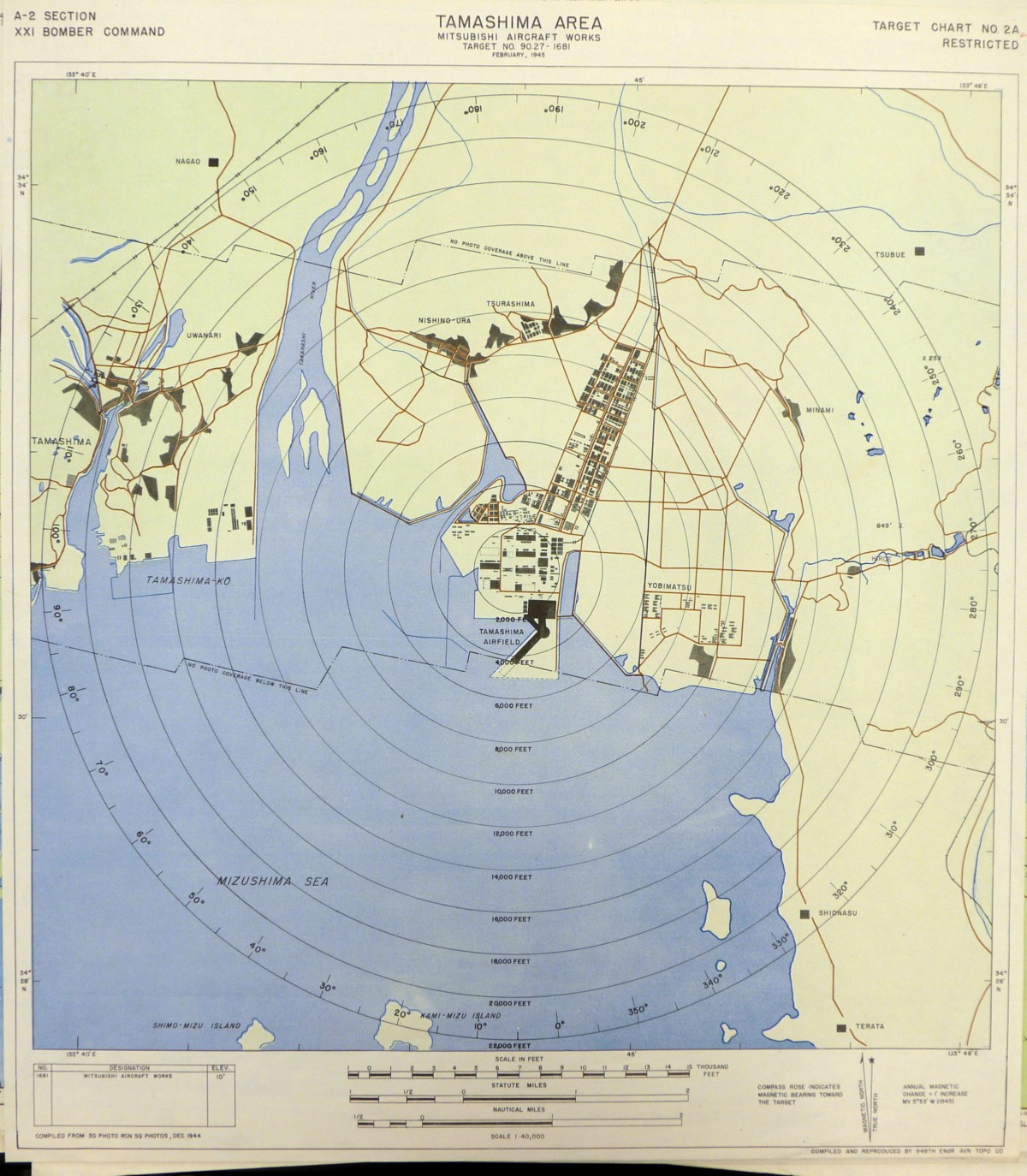
- Tamashima Area
-
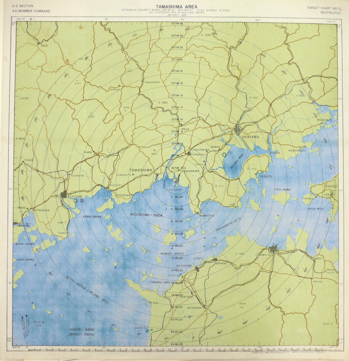
- Tamashima Area
-
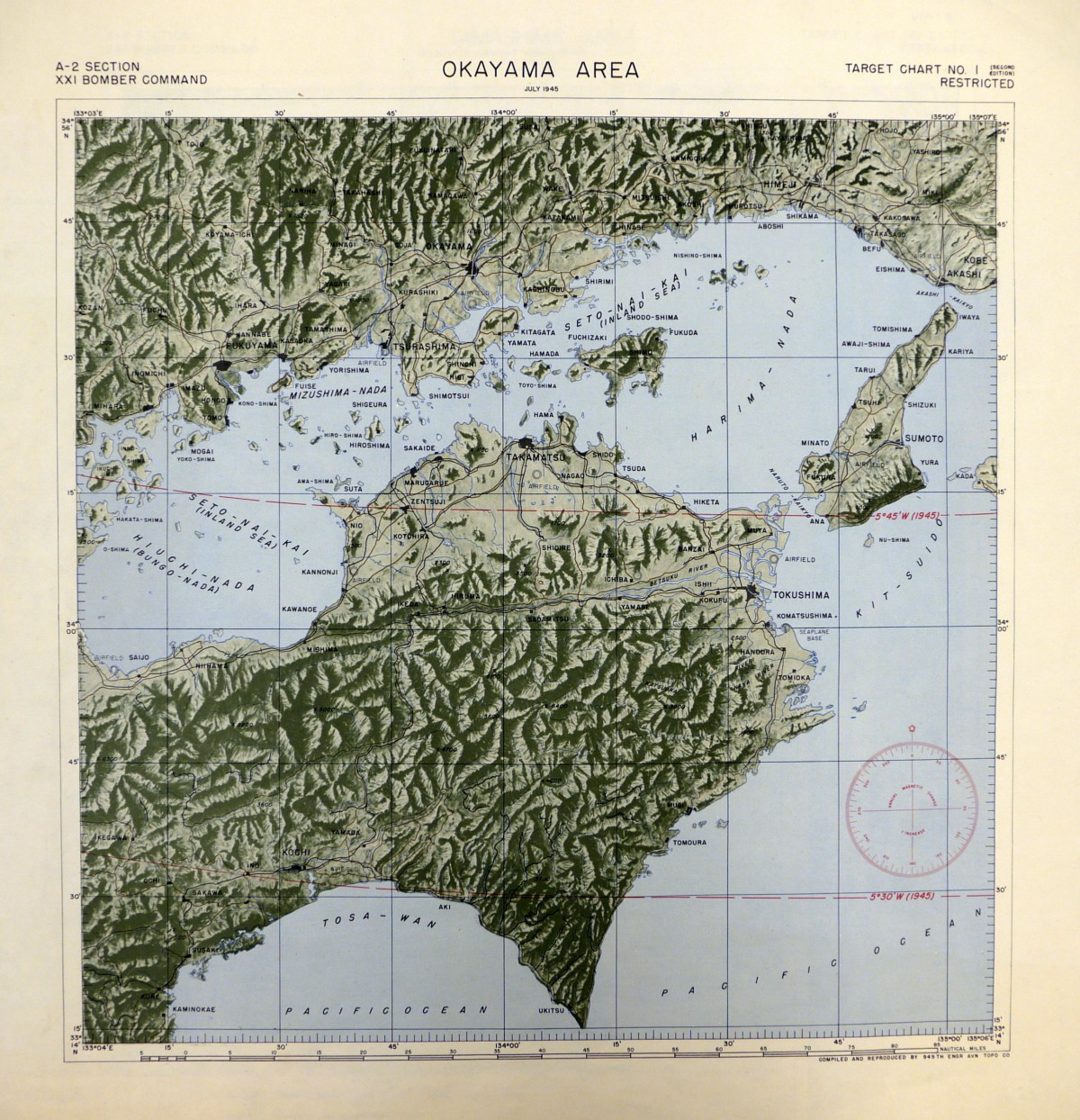
- Okayama area